Introduction to GPS Devices and Their Importance for British Hikers
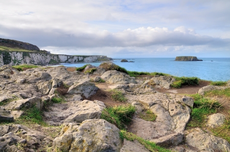
Over the past decade, GPS technology has transformed how outdoor enthusiasts navigate the varied and often challenging landscapes of the British countryside. As hiking continues to grow in popularity across the UK—from the rugged fells of the Lake District to the rolling hills of the Cotswolds—reliable navigation aids have become essential for both safety and enjoyment. Modern GPS devices offer far more than simple location tracking; they provide detailed mapping, route planning, weather updates, and even emergency communication capabilities. The increasing unpredictability of British weather, coupled with diverse terrain ranging from dense forests to open moorland, makes electronic navigation aids particularly invaluable. Today, seasoned leaders and casual ramblers alike are turning to GPS units not only for peace of mind but also as a complement to traditional map and compass skills. This growing reliance reflects an evolution in best practice for safe and responsible hiking, ensuring that walkers can explore with confidence while respecting the unique demands of the UK’s countryside.
2. Key Features of GPS Devices for the UK Countryside
When selecting a GPS device for hiking in the British countryside, it is essential to focus on features tailored to the unique demands of this environment. The rolling hills, unpredictable weather, and extensive footpath networks require robust and reliable navigation tools. Below is a detailed look at critical specifications and functions that should guide your purchasing decision.
Ordnance Survey (OS) Map Compatibility
For any serious walker or trekker in the UK, compatibility with Ordnance Survey mapping is paramount. OS maps provide the most detailed and up-to-date information on footpaths, bridleways, contour lines, and landmarks specific to Britain. GPS devices offering seamless integration with OS maps enable precise route planning and real-time navigation, dramatically reducing the risk of getting lost in remote areas.
Weather Resistance
The British climate is famously variable; rain, fog, and wind can arrive unexpectedly even in summer months. A suitable GPS device must be both water-resistant and dustproof, meeting at least an IPX7 rating to withstand immersion in water and resist ingress from mud or sand. This resilience ensures consistent performance regardless of the elements.
Battery Longevity
Long-distance hikes in regions like the Lake District or Scottish Highlands often span multiple days without guaranteed access to mains power. Extended battery life—preferably 15 hours or more on a single charge—is vital. Some models offer replaceable batteries or solar charging options, which can be invaluable during extended expeditions.
Altitude Tracking and Barometric Sensors
Navigating Britain’s varied terrain, from coastal paths to mountainous regions such as Snowdonia, requires accurate altitude tracking. Devices equipped with barometric altimeters provide precise elevation data, assisting with route planning and helping users anticipate changes in weather conditions related to altitude shifts.
Emergency Functions
The ability to signal for help in remote areas is a crucial safety feature. Many modern GPS units now incorporate SOS messaging via satellite communication (such as Garmin’s inReach series), providing peace of mind when mobile coverage is non-existent. Additional emergency functions may include digital compasses, audible alarms, and automatic location sharing with trusted contacts.
Feature Comparison Table
| Specification | Importance for UK Hiking | Recommended Standard |
|---|---|---|
| OS Map Compatibility | Essential for local navigation | Full OS integration (1:25k/1:50k) |
| Weather Resistance | Copes with rain/mud/wind | IPX7 or higher |
| Battery Longevity | Sustains multi-day treks | >15 hours active use |
| Altitude Tracking | Counters varied terrain | Barometric altimeter included |
| Emergency Functions | Covers signal blackspots | SOS/satellite messaging capability |
Selecting a GPS device with these key features ensures you are well-equipped for the distinct challenges of hiking across Britain’s diverse landscapes, enhancing both your safety and enjoyment.

3. Popular GPS Device Brands in the UK Market
The British countryside presents unique challenges for hikers, and choosing a reliable GPS device is crucial for safety and navigation. Several trusted manufacturers dominate the UK market, each offering distinctive features tailored to the needs of British walkers.
Garmin: The Industry Standard
Garmin has established itself as a market leader thanks to its robust build quality, extensive mapping options, and excellent after-sales support. Popular models such as the Garmin eTrex and GPSMAP series are favoured by seasoned hikers for their accuracy, battery longevity, and ease of use. With dedicated UK-based customer service and regular map updates that include Ordnance Survey integration, Garmin remains a top choice for those traversing the varied terrains of the Lake District, Scottish Highlands, or South West Coast Path.
SATMAP: Designed with British Walkers in Mind
SATMAP is renowned for designing devices specifically for the UK’s walking community. The Active 20 model stands out for its rugged construction and user-friendly interface, featuring detailed British mapping and compatibility with OS Explorer maps. SATMAP’s after-sales support is locally based, ensuring swift repairs and advice—an important consideration when relying on technology in remote areas.
TwoNav and Other Notable Brands
While not as ubiquitous as Garmin or SATMAP, brands like TwoNav offer advanced navigation solutions, particularly appealing to tech-savvy hikers who value customisable routing and connectivity. TwoNav devices are compatible with a variety of mapping formats and are supported by a growing network of UK retailers. Additionally, smaller brands such as Memory-Map have built strong reputations for their focus on British mapping data and responsive customer assistance.
Brand Reputation & After-Sales Support
When selecting a GPS device, it is vital to consider not only technical specifications but also local availability of service centres, warranty coverage, and the accessibility of help should an issue arise during your expedition. Established brands provide peace of mind through comprehensive support networks across the UK—an asset that cannot be underestimated when planning multi-day hikes far from urban centres.
Summary
The leading GPS brands available in Britain offer much more than basic navigation—they provide tailored solutions for British terrain, backed by reputable after-sales service. Whether you prioritise durability, mapping detail, or responsive support, choosing a brand with a solid presence in the UK market will ensure your hiking adventures remain safe and enjoyable.
4. Comparing GPS Devices: Portability, Usability, and Map Support
When venturing into the British countryside, selecting the right GPS device is crucial for both safety and enjoyment. The main categories—handheld GPS units, wearable devices, and smartphone-based solutions—offer distinct advantages and limitations. This section provides a technical comparison of these options with particular reference to their performance during hillwalking and rambling across varied British terrains.
Portability and Practicality
| Device Type | Weight & Size | Battery Life | Weather Resistance |
|---|---|---|---|
| Handheld GPS | Moderate to bulky; fits in a large pocket or rucksack lid | 15-30+ hours (replaceable batteries) | Typically IPX7 rated, robust against rain and mud |
| Wearable GPS (Watches) | Lightweight; worn on wrist | 8-60 hours (depending on mode) | Water-resistant; suitable for British showers |
| Smartphone-Based GPS | Slimline; fits in any pocket | 5-12 hours (subject to app use & weather) | Varying resistance, often needs protective case in UK weather |
Usability During Hillwalking & Rambling
Interface Design and Operation with Gloves or Wet Hands
- Handheld GPS: Physical buttons are a boon in cold, wet conditions common on fells and moors, allowing reliable operation without removing gloves.
- Wearable Devices: Touchscreens can be less effective in rain but most reputable models offer physical controls as well.
- Smartphones: Capacitive screens struggle when wet or used with gloves—a notable disadvantage during changeable British weather.
User Experience in Typical UK Environments
- Handheld Units: Purpose-built for navigation; menus are optimised for wayfinding, with clear mapping even in poor visibility.
- Wearables: Excellent for tracking position at a glance but often limited by smaller screen real estate for detailed map reading.
- Smartphones: Offer versatile mapping apps but are prone to rapid battery drain in cold, damp conditions. Signal loss can be problematic in remote dales or uplands unless offline maps are preloaded.
Map Support and Navigation Features
| Device Type | Map Compatibility (UK OS Maps) | Route Planning Features | SOS/Emergency Functions |
|---|---|---|---|
| Handheld GPS | Comprehensive support for Ordnance Survey 1:25k/1:50k maps; preloaded or via microSD cards | Diverse route planning, GPX import/export; breadcrumb trails standard | Many offer SOS messaging via satellite (subscription required) |
| Wearables (Watches) | Select models support UK topo maps; display is more basic than handhelds | Simplified route following, waypoint marking, back-to-start navigation common | Certain premium models include incident detection & emergency alerts via paired phone connection |
| Smartphone-Based GPS Apps | Broadest range—Ordnance Survey, ViewRanger, Komoot etc.; dependent on app choice and subscriptions for offline use | User-friendly interfaces for planning and sharing routes; voice guidance available on some platforms | No direct SOS unless using specialist apps or mobile signal is available; dependent on network coverage which can be patchy on British hillsides |
Summary of Key Considerations for the British Countryside Enthusiast
The decision between handheld, wearable, and smartphone-based GPS devices should account for expected weather conditions, the need for reliable Ordnance Survey mapping, battery longevity, and ease of use with gloves or cold fingers. While smartphones are highly convenient and familiar to many ramblers, they require careful preparation—such as loading offline maps and carrying power banks. Handheld units remain the gold standard for reliability and ruggedness during extended trips across the Lake District or Scottish Highlands. Wearables offer a lightweight compromise ideal for shorter excursions or as a backup navigation tool. For group leaders or those heading off the beaten track, investing in a dedicated handheld unit with satellite SOS capability is strongly recommended.
5. Recommendations: Best GPS Devices for Different Types of Hikers
Choosing the right GPS device for hiking in the British countryside depends greatly on your experience, group size, and the typical conditions you expect to encounter. Below is tailored advice to help solo explorers, family groups, and seasoned backpackers select the most suitable GPS unit for their adventures across the UK’s diverse landscapes.
Solo Explorers: Prioritising Reliability and Simplicity
For those venturing out alone, especially on less-trodden paths or remote moorland, reliability and ease of use are paramount. Devices such as the Garmin eTrex 32x offer robust navigation features with exceptional battery life, compact design, and straightforward interface—ideal for solo walkers who want reassurance without excessive bulk. For those preferring an even lighter load, the OS Maps app on a smartphone, paired with a rugged waterproof case and power bank, can be a practical solution for well-marked routes close to civilisation.
Family Groups: Safety Features and User-Friendly Interfaces
Families require devices that balance functionality with simplicity and safety. The Garmin GPSMAP 67 stands out due to its clear display, intuitive menu system, and excellent battery performance. Importantly, it offers live tracking when paired with a compatible smartphone—helpful for keeping tabs on adventurous youngsters. The device’s waterproof rating ensures peace of mind during sudden showers common in the Lake District or Scottish Highlands. Alternatively, devices like the Satmap Active 20, which features Ordnance Survey mapping as standard, allow families to visualise routes easily and adapt plans on the go.
Seasoned Backpackers: Advanced Features for Challenging Conditions
Experienced backpackers tackling multi-day treks or navigating challenging terrain will benefit from advanced models such as the Garmin Montana 700i. This device combines top-tier mapping capabilities (including full OS mapping), two-way satellite messaging via inReach technology for emergencies, and durable construction suited to Britain’s unpredictable weather. Its large touchscreen is glove-friendly—an advantage during winter hillwalking or wet spells on the Pennine Way. For those requiring ultimate versatility, the Garmin Fenix 7 multisport watch offers wrist-based navigation alongside comprehensive fitness tracking—ideal for ultralight expeditions where every gram counts.
Key Considerations for UK Hiking Conditions
No matter your group size or experience level, always consider weatherproofing (IPX7 minimum), battery longevity (at least 16 hours active use), and mapping compatibility with UK-specific formats such as Ordnance Survey or Harvey maps. These factors ensure your chosen device remains reliable whether you’re crossing Dartmoor’s foggy tors or traversing the Yorkshire Dales’ limestone pavements.
The Bottom Line
Selecting a GPS device tailored to your needs enhances both safety and enjoyment when exploring Britain’s countryside. By matching device features to your group profile and anticipated conditions, you’ll be well-equipped for everything from gentle family rambles to demanding solo expeditions across wild terrain.
6. Safety Considerations and Responsible Use in UK Hiking Contexts
While GPS devices have become indispensable tools for navigation across the British countryside, their responsible use remains paramount. To ensure safety, hikers must adopt a holistic approach, blending modern technology with time-honoured skills and an understanding of local regulations.
Best Practices for Safe Navigation
Relying solely on a GPS device can be risky, particularly in areas where signal coverage is patchy or batteries may fail due to cold or prolonged use. Always plan your route in advance and carry a physical map and compass as backup. Check your GPS device’s battery life before setting out, and consider carrying spare batteries or a portable charger. Regularly update your waypoints and track logs to avoid getting disoriented, especially in changeable British weather conditions where visibility can deteriorate quickly.
Integrating GPS with Traditional Map and Compass Skills
A proficient hiker in the UK countryside should view GPS as an enhancement rather than a replacement for traditional navigation techniques. Familiarise yourself with Ordnance Survey maps—an essential resource for the UK—and practice orienting them using a compass. In situations where electronic devices fail or mapping data is incomplete, these foundational skills are crucial for maintaining your bearings and ensuring safe passage.
Guidance on Digital Etiquette
Responsible use of GPS technology extends beyond personal safety; it involves respecting fellow hikers’ privacy by avoiding unnecessary geotagging of sensitive locations and refraining from broadcasting live positions unless necessary for group safety. When sharing routes or location data online, be mindful of local landowners’ wishes and avoid contributing to overcrowding at lesser-known sites.
Countryside Access Laws and Rights of Way
The UK’s countryside is governed by a complex network of rights of way and access laws, such as those outlined under the Countryside and Rights of Way Act 2000 (CRoW). Before heading out, consult official sources to confirm legal footpaths, bridleways, or open access land along your planned route. GPS devices are invaluable for verifying your position relative to these boundaries, but always respect signage, closures, and any temporary diversions. Remember that responsible hiking also means leaving no trace: stick to marked paths wherever possible and avoid disturbing livestock or wildlife.
By integrating technology with traditional knowledge and adhering to both digital etiquette and countryside laws, hikers can enjoy the best of Britain’s outdoors safely and sustainably.