1. Understanding the Met Office and Its Role
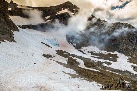
When venturing into the rugged embrace of the British hills, whether it’s the rolling fells of the Lake District or the mist-shrouded peaks of Snowdonia, being in tune with the weather is more than a matter of comfort—it’s a question of safety and success. At the heart of this essential knowledge stands the Met Office, Britain’s official source for weather and climate information. Established in 1854, the Met Office has been a steadfast companion to everyone from farmers and fishermen to hillwalkers and outdoor enthusiasts, earning a reputation built on scientific rigour and local expertise. For those drawn to the wild tapestry of our uplands, trusting in the Met Office’s forecasts is not just tradition; it’s common sense. Their reports are grounded in cutting-edge technology, skilled meteorologists, and decades of understanding the quirks of British weather—making them an indispensable resource before you lace up your boots or shoulder your pack. As cloud shadows chase across heather moors and sudden squalls sweep through ancient valleys, knowing how to interpret these trusted forecasts can turn an ordinary day outdoors into a safe and memorable adventure.
2. Navigating Met Office Weather Reports
Before setting off into the British hills, it’s essential to consult a reliable weather report. The Met Office is the gold standard for UK forecasts and offers dedicated hill and mountain reports that go far beyond general city weather. These can be found on the Met Office website under “Mountain Weather” or via their mobile app. For those venturing into places like Snowdonia, the Lake District, or the Scottish Highlands, selecting the relevant regional forecast ensures you receive tailored advice on conditions at higher elevations.
Finding Detailed Hill Forecasts
The main sections to look for in a Met Office hill report include:
| Section | Description |
|---|---|
| Headline | A summary of the day’s main weather risks—ideal for a quick overview before breakfast or lacing your boots. |
| Weather Description | A narrative of expected conditions, including cloud cover, precipitation type (rain, sleet, snow), and visibility changes. |
| Wind Speed & Direction | Particularly vital in exposed uplands; look out for terms like “blustery,” “gusts,” or “gale-force.” |
| Temperature | Often given for both valley and summit—crucial for planning clothing and gear. |
| Hazards | Warnings about ice, avalanches, lightning, or severe wind chill—always worth noting before stepping out. |
Interpreting Local Terminology
The language of British hill weather has its own poetry—a drizzle isn’t just rain, but a soft curtain; “clag” refers to low cloud enveloping the tops; “haar” means coastal fog rolling in from the North Sea. Understanding these terms helps you visualise what awaits above the tree line. Here are a few commonly used phrases:
| Term | Meaning | Typical Location/Use |
|---|---|---|
| Mist/Clag | Low-lying cloud reducing visibility on summits and ridges. | Pennines, Lake District tops |
| Dreich | Dull, damp, overcast weather with persistent drizzle. | Scottish Highlands, Yorkshire Dales |
| Breezy/Freshening Winds | Increasing wind speeds; may affect balance on exposed paths. | Cairngorm plateau, open moorland |
| Showers Merging to Rain | Sporadic rainfall becoming more continuous—pack an extra layer! | Western hills and valleys after midday |
The Value of Trusted Sources
The Met Office collaborates closely with local mountain rescue teams and uses data from remote sensors across key hill areas. This means their warnings are rooted in both science and lived experience—a blend as timeless as Britain’s landscapes themselves. Always cross-reference their reports with local updates from national park visitor centres or ranger stations if possible.
If you learn to read these reports with care and respect their nuance, every ascent becomes not just safer but richer—a meeting of land, sky, and story in every step you take amongst the hills.

3. Decoding Met Office Weather Warnings
The British hills are as unpredictable as they are beautiful, and the Met Office weather warnings serve as your trusted companion before you set foot on moor or ridge. Understanding these warnings is more than a practical skill—it’s an art in reading the moods of the land and sky, ensuring each adventure is both memorable and safe.
A Breakdown of the Warning System
The Met Office issues weather warnings using a familiar traffic light system—Yellow, Amber, and Red—each indicating increasing levels of risk and potential disruption. These warnings cover various hazards: rain, wind, snow, ice, fog, and even thunderstorm events. Each warning comes with detailed regional information, but for those venturing into the high places—be it the fells of Cumbria or the rugged Pennine moors—the implications can be uniquely challenging.
What the Colour Codes Mean
Yellow: Be aware. Conditions could change rapidly; stay alert to updates. While daily life might continue as normal in lowland towns, a yellow warning in upland areas often means slick paths, gusty winds across exposed ridges, or sudden mists rolling over the heather.
Amber: Be prepared. There’s an increased likelihood of severe weather impacts—travel may be disrupted and safety compromised. In the hills, this could mean torrents surging down previously gentle streams or winds howling across summits strong enough to knock you off your feet.
Red: Take action. Dangerous conditions are expected. Red warnings are rare but serious; venturing onto open moorland or high ground during these times is not just foolhardy but potentially life-threatening.
The Particular Implications in Upland and Moorland Regions
The wild spaces of Britain amplify every nuance of weather. A yellow warning for rain might mean a damp commute in town—but on Dartmoor, it can turn tracks into boggy quagmires. Amber winds battering city windows might simply rattle the panes; on the Lake District’s crags, they become invisible hands pushing hikers towards perilous drops. Always interpret warnings with respect to altitude and exposure: what seems mild below can be magnified above the treeline.
In essence, each weather warning should be read through the lens of your planned route and the nature of Britain’s uplands. Listen to what the Met Office tells you—not just as data, but as stories whispered by wind and cloud across our ancient hills.
4. Applying Weather Reports to Hill Planning
The art of hill walking in Britain is as much about reading the land as it is about understanding the sky. While Met Office reports offer a crucial foundation, blending this forecast with your own experience and observations is the key to venturing out safely. Before lacing up your boots, take a moment to combine the science of meteorology with the subtle cues you gather from the landscape itself.
Blending Forecast Data with Local Knowledge
Forecasts provide a broad brushstroke, but each valley, ridge, and summit can paint a different picture. For example, a southerly wind on Dartmoor may bring drizzle and swirling mists, while in the Scottish Highlands it could whip snow over exposed crests. Compare the official report with your memory of how weather behaves in your chosen area—does that glen tend to flood quickly? Does this peak become shrouded in cloud when others stay clear?
Key Questions to Ask Before You Set Out
| Forecast Information | On-the-Ground Experience | Safe Planning Actions |
|---|---|---|
| Wind speeds above 30 mph | Are there exposed ridges on your route? | Plan lower level alternatives or sheltered paths |
| Heavy rain warnings | Do streams cross your path, or does terrain become boggy? | Check for bridges, avoid flood-prone tracks, carry extra gear |
| Falling temperatures & risk of ice | Does your route traverse north-facing slopes? | Packing microspikes or choosing sunlit aspects where possible |
| Poor visibility expected (fog/mist) | Is navigation straightforward or complex? | Carry map & compass; ensure all group members are familiar with escape routes |
The Value of Humble Observation
The British hills reward those who pause and watch. Look at the movement of clouds over the fells, feel the chill on the wind’s edge, listen for distant rumbles that speak of storms rolling in. These small acts of attention help you sense when conditions might deviate from what was forecast—and give you time to make adjustments before you’re caught out.
Sensible Flexibility: The Hallmark of Good Hillcraft
No matter how detailed your planning, be prepared to adapt. If you reach a summit shrouded in unyielding cloud or find rivers running higher than expected, turn back or seek an alternative. There’s wisdom in letting the hills dictate your pace and path; after all, they’ve stood far longer than any forecast ever will.
5. Reading the Signs: Weather, Landscape, and Local Lore
Beyond official forecasts and warnings, there is a wealth of wisdom to be found in the British hills themselves—if only you know how to look. For generations, hillwalkers, shepherds, and climbers have tuned into the subtle clues woven into the landscape, learning to read nature’s quiet language.
Noticing Subtle Environmental Clues
The sky above the fells often tells its own story. Pay close attention to the movement and shape of clouds; a sudden thickening or lowering over a particular ridge may hint at approaching rain long before your phone pings with an alert. In the Lake District or on Dartmoor, a distant curtain of grey sweeping across the valley often signals an incoming shower. Look for swallows skimming low to the ground—a sure sign that insects (and therefore rain) are near. Even the feel of the wind shifting on your cheek can speak volumes about what’s brewing beyond the horizon.
Listening to British Hill Traditions
There’s an old saying among fell-walkers: “Red sky at night, shepherd’s delight; red sky in morning, shepherd’s warning.” This timeless rhyme reminds us that weather has always been part of local lore. You might notice sheep huddling tightly together before a storm or hear skylarks go silent as pressure drops—these behaviours aren’t just charming tales but time-honoured signs that seasoned walkers still respect.
Tips for Attuning Yourself to Place
- Pause on your route to observe how mist clings to certain slopes while leaving others clear—it may reveal wind direction and shelter.
- Listen for changes in bird calls; sudden quiet often precedes rough weather.
- Feel underfoot: boggy ground that seems unusually soft could mean recent heavy rainfall uphill or a hidden spring triggered by changing weather patterns.
The more you walk Britain’s wild places, the richer your understanding becomes. Combining Met Office reports with these lived experiences weaves together science and story—letting you move through the hills with both confidence and awe.
6. Resources for Real-Time Updates and Further Learning
When you’re wandering among the sweeping hills of Britain, whether scrambling up the Lake District’s craggy paths or tracing ancient ridgeways in the Peak District, staying tuned to the latest weather is as vital as a well-packed flask. Beyond the Met Office’s own website, several trusted resources and community tips can help keep your journey both safe and enjoyable.
Essential Apps for Hillwalkers
The Met Office app itself is a staple, offering detailed forecasts with hour-by-hour updates tailored to specific locations—perfect for when you’re plotting a route across shifting upland terrain. For those seeking even greater detail, apps such as Mountain Weather UK and Rain Radar UK provide hyper-local conditions and real-time radar imagery, helping you spot that approaching squall before it sweeps over the fells.
Reliable Radio Broadcasts
There’s something reassuringly traditional about tuning into BBC Radio 4’s Shipping Forecast or their regular weather bulletins, especially when phone signal grows faint among high ridges. Local radio stations often provide up-to-the-minute reports, sharing warnings relevant to your current region. Many seasoned ramblers still swear by carrying a small portable radio—just in case technology falters where the wind howls loudest.
Trusted Websites and Forums
For deeper insight, websites like Mountain Weather Information Service (MWIS) deliver forecasts crafted specifically for hillgoers. Their plain-English summaries distil complex meteorology into clear advice—like when hill fog might cloak summits or gusty winds could make exposed routes treacherous. The Ramblers Association and British Mountaineering Council websites also post timely updates and offer invaluable safety resources.
Wisdom from Local Communities
If you want to read the land as locals do, seek advice from fell-running clubs and rambling groups who know every contour by heart. Many have online forums or social media groups where they share not just route conditions but lived experience: which streams swell fastest after rain, which paths grow slickest in autumn mists. A friendly word at a village pub or visitors’ centre can yield practical tips no forecast will mention.
Learning for Life on the Hills
The hills are ever-changing teachers; each outing reveals new lessons about reading clouds, feeling the wind shift, or noticing the hush before rain. By blending official sources with local wisdom—listening to the land as much as your smartphone—you’ll develop your own sixth sense for weather in Britain’s wild places. Stay curious, stay prepared, and let each walk deepen your connection to both forecast and fell.