1. Understanding the UK Mountain Environment
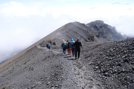
The mountains of the United Kingdom present a diverse and challenging landscape, each region characterised by its own unique features and demands. From the rugged majesty of the Scottish Highlands to the iconic peaks of the Lake District and the dramatic ridges of Snowdonia, these environments are as varied as they are beautiful. Understanding their distinctive qualities is crucial for anyone venturing into these upland areas.
Distinctive Regional Characteristics
The Scottish Highlands are renowned for their vast, remote expanses, steep corries, and unpredictable weather, with Munros such as Ben Nevis offering both inspiration and significant challenge. The Lake District, while more accessible, is famed for its complex network of fells, valleys, and tarns—terrain that can be deceptively demanding in poor conditions. In Snowdonia, sharp ridgelines like Crib Goch and a mix of rocky outcrops and boggy ground require careful navigation and a respect for rapidly shifting conditions.
Weather Patterns and Considerations
UK mountain weather is notoriously changeable. Atlantic fronts often bring heavy rain, strong winds, and mist with little warning—particularly in Scotland. Even in summer, temperatures on summits can fall below freezing with wind chill. Visibility may deteriorate swiftly, making navigation skills essential. Always check the Mountain Weather Information Service (MWIS) or Met Office mountain forecasts before heading out.
Terrain Hazards
The terrain across these regions ranges from well-trodden paths to pathless heather moorland and exposed rocky scrambles. Loose scree, wet grass, and hidden drops present constant hazards. In winter months, snow and ice add complexity—especially in the Highlands where avalanche risk must be considered.
Key Takeaway
An informed appreciation of local geography, weather patterns, and terrain types is fundamental to safe mountain travel in the UK. Each area demands a tailored approach; no two mountains or days are ever quite the same.
2. Essential Preparation and Planning
Effective preparation and meticulous planning are the cornerstones of safe mountain activities across the UK, whether you are navigating the rugged peaks of the Scottish Highlands or exploring the dramatic terrain of Snowdonia. Attention to detail in this early phase can make all the difference between a successful outing and a hazardous situation.
Route Selection: Matching Challenge with Capability
Selecting a suitable route is fundamental. Take time to research potential routes using authoritative sources such as Ordnance Survey maps, local guidebooks, and reputable online platforms like Walkhighlands or the Snowdonia National Park Authority. Evaluate factors including length, elevation gain, technical difficulty, and current trail conditions. Always choose a route that aligns with your groups experience and fitness levels.
Sample Route Selection Criteria Table
| Criteria | Considerations | Recommended Resources |
|---|---|---|
| Difficulty Level | Technical skills required, exposure, scrambling sections | Guidebooks, local ranger advice |
| Distance & Duration | Total mileage, estimated time to complete | Ordnance Survey maps, GPS apps |
| Weather Impact | Susceptibility to wind, rain, snow, fog | Meteorological Office forecasts |
| Group Capability | Fitness level, medical conditions, group size | Past experience records |
Risk Assessment: Proactive Hazard Management
A thorough risk assessment should identify both objective hazards (such as river crossings, steep ascents, or scree slopes) and subjective hazards (including group inexperience or fatigue). Implement control measures—such as carrying suitable equipment or setting turnaround times—and ensure all participants are briefed on key risks before departure.
Sourcing Reliable Weather Forecasts: Navigating UK’s Changeable Conditions
The UK’s mountainous regions are notorious for rapidly changing weather. Always consult multiple reliable sources such as the Met Office Mountain Weather Forecasts, Mountain Weather Information Service (MWIS), and local visitor centres. Factor forecasted visibility, precipitation, wind speed, and temperature into your plans; never underestimate how swiftly conditions can deteriorate at altitude.
The Importance of Filing a Route Plan
Before setting out, it is critical to file a detailed route plan with a trusted contact. Include information such as intended start/finish points, estimated timings, planned stops, party members’ details, and emergency contacts. This simple step greatly enhances your safety in the event of an incident by enabling rescue teams to respond promptly if you fail to return as expected.
Understanding Access Rights under UK Legislation
The UK has distinct access laws depending on location:
- Scotland: The Land Reform (Scotland) Act 2003 grants extensive rights of responsible access across most land and inland water.
- England & Wales: The Countryside and Rights of Way Act 2000 (CRoW) allows open access on designated “Access Land”, but not everywhere.
- Northern Ireland: Public access is more restricted; always seek permission where necessary.
Respect signage and local guidance at all times; responsible behaviour ensures continued access for everyone.
3. Kit and Equipment: What to Carry in the UK Hills
Ensuring you are properly equipped is fundamental to safe mountain travel across the UK, where weather can change rapidly and terrain is often challenging. Whether traversing the rugged Scottish Highlands or navigating the peaks of Snowdonia, carrying the right kit tailored to British conditions can make all the difference.
Clothing for British Mountain Weather
The UK’s mountains are notorious for unpredictable and often harsh weather. Layering is essential: start with a moisture-wicking base layer, add an insulating mid-layer such as fleece or synthetic fill, and top off with a fully waterproof and windproof shell. Always pack a warm hat, gloves (preferably two pairs), and spare socks. Gaiters and sturdy, waterproof boots are indispensable, especially in boggy areas or during winter months.
Navigation Tools
Reliable navigation is critical, particularly given how quickly mist can descend on British hills. Always carry an Ordnance Survey map appropriate to your route (ideally laminated), a traditional compass, and ensure you know how to use both. While GPS devices and smartphone apps offer valuable support, they should never replace map and compass skills due to battery limitations and signal loss in remote areas.
Safety Gear
Key safety items include a whistle for signalling, a head torch with spare batteries (daylight hours are short in winter), and a personal first aid kit containing blister plasters, bandages, tape, painkillers, and any personal medication. A bivvy bag or emergency shelter provides vital protection if forced to stop unexpectedly. Additionally, always carry plenty of high-energy snacks and sufficient water; water purification tablets are wise for longer days or wild camping.
Emergency Equipment
Mobile phone coverage is patchy in many upland areas; consider carrying a portable power bank and registering your mobile with the 999 emergency SMS service before your trip. For remote expeditions or solo walkers, a Personal Locator Beacon (PLB) or satellite messenger offers an additional safety net. Ensure someone knows your planned route and expected return time—a simple but crucial precaution widely practised among experienced UK hillwalkers.
Summary Checklist
To summarise, your core kit should include: layered clothing suitable for rapid weather changes, durable footwear, map and compass (plus GPS as backup), head torch, whistle, first aid kit, emergency shelter/bivvy bag, high-calorie food and water supplies, communication devices with backup power, and any necessary technical gear for winter or scrambling routes. Adhering to these equipment recommendations will help ensure both your safety and enjoyment in Britain’s diverse mountain landscapes.
4. Navigation, Wayfinding, and Local Mapping Standards
Effective navigation is fundamental to mountain safety across the UK, from the misty peaks of the Scottish Highlands to the rugged trails of Snowdonia. Mastery of traditional and modern navigation tools not only enhances your confidence but also ensures your group’s safety, especially in rapidly changing weather conditions.
Best Practices for Reading OS Maps
The Ordnance Survey (OS) map is a cornerstone for any walker or leader in the UK. Familiarise yourself with key features such as contour lines, grid references, rights of way, and symbols unique to the British mapping system. Always carry an appropriate scale—1:25,000 maps provide detailed path and terrain information, while 1:50,000 maps offer a broader overview useful for route planning.
| Feature | 1:25,000 Scale | 1:50,000 Scale |
|---|---|---|
| Path detail | High (footpaths, bridleways) | Moderate (main routes) |
| Contour interval | 5 metres | 10 metres |
| Rights of way marked | Yes | Partial/Main routes only |
| Shelters & features | Detailed | Selective/highlighted only |
Navigating with Compass and GPS Devices
A reliable compass remains indispensable on UK hills where electronic devices may fail due to weather or battery depletion. Practise taking bearings, orienting your map, and triangulating your position. Complement this with GPS devices or smartphone apps as a secondary tool—ensure you have downloaded offline maps and understand how to interpret digital data alongside paper maps.
Compass vs GPS: Strengths & Limitations at a Glance
| Compass | GPS Device/Smartphone App | |
|---|---|---|
| Main Advantage | No batteries required; reliable in all weathers. | Accurate location pinpointing; easy route tracking. |
| Main Limitation | User error; requires map-reading skill. | Batteries can fail; signal may be lost in remote areas. |
| Recommended Use Case | Poor visibility; traditional navigation training. | Supplementing navigation; confirming position. |
Recognising Local Path Signage and Waymarks
The UK boasts an extensive network of public rights of way including footpaths, bridleways, and byways—each marked by distinct signs and waymarks. In England and Wales, National Trails are signposted by acorn symbols; in Scotland, core paths often use green markers. Always check local authority guidance before heading out, especially as signage standards can vary between regions.
Common UK Path Signs and Waymarks Overview
| Symbol/Marker | Description/Meaning |
|---|---|
| Acorn symbol (England & Wales) | National Trail route marker (e.g., Pennine Way) |
| Yellow arrow on post | Public Footpath (pedestrians only) |
| Blue arrow on post | Bridleway (pedestrians, cyclists, horse riders) |
| Purple arrow on post (Wales) | Byway open to all traffic (including vehicles) |
| Green post/roundel (Scotland) | Core path for public access under Scottish Outdoor Access Code |
Your Rights of Way and Land Use Responsibilities in the UK
The UK’s unique access laws require walkers and leaders to respect both legal rights and private land boundaries. In England and Wales, use designated rights of way unless you are on Access Land (highlighted on OS Explorer maps). In Scotland, the Land Reform Act grants wider access but places responsibility on users to act responsibly—leave gates as found, avoid disturbing livestock, and minimise impact on fragile habitats.
Key Points for Responsible Navigation:
- Avoid trespassing by sticking to signed paths or Access Land areas.
- If unsure about access status, consult latest OS maps or local authority websites.
- Countryside Code: “Respect other people; protect the natural environment; enjoy the outdoors.”
- Liaise with local rangers or Mountain Rescue for up-to-date advice in remote regions.
A strong grasp of these navigation principles—and respect for local practices—ensures a safer and more rewarding experience wherever your adventures take you across Britain’s mountains.
5. Staying Safe: Group Leadership and Decision-Making
Effective group leadership and sound decision-making are fundamental to mountain safety throughout the UK’s varied landscapes, from the rugged Scottish Highlands to the challenging terrain of Snowdonia. These skills not only ensure a positive experience for all participants but are also essential in responding to rapidly changing weather and unforeseen hazards.
Principles of British Outdoor Leadership
British outdoor leadership is built on a foundation of inclusivity, clear communication, and situational awareness. The leader’s role goes beyond navigation; it includes assessing group abilities, maintaining morale, and fostering a culture of shared responsibility. Open dialogue is encouraged, allowing members to voice concerns or observations that might otherwise be overlooked. This approach supports collaborative problem-solving and helps mitigate risks before they escalate.
Dynamic Risk Assessment and Adaptability
Conditions in British mountains can shift rapidly—mist may descend without warning, or river crossings become treacherous after rainfall. Leaders must conduct ongoing dynamic risk assessments, balancing the original plan with current realities. Decisions should be based on both environmental factors and the wellbeing of the group. Adapting routes or turning back are not signs of failure but hallmarks of responsible leadership.
Techniques for Effective Group Management
Clear briefings at key points—before setting out, at critical junctions, or when circumstances change—are vital. Leaders should ensure everyone understands the day’s objectives, expected challenges, and individual roles within the group. Positioning experienced walkers at both the front and rear helps maintain pace and cohesion. Regular headcounts and discreet welfare checks reinforce safety without undermining confidence.
Empowering Participation in Decision-Making
Modern British outdoor leadership values input from all members. Encouraging less-experienced walkers to share their perspectives fosters engagement and early identification of issues such as fatigue or discomfort. When decisions need to be made—such as whether to proceed over exposed ground or seek shelter—the leader weighs expert advice alongside group consensus, always prioritising safety.
Crisis Response and Learning from Experience
If an incident occurs, decisive action is essential: assign clear roles (e.g., first aider, communicator), use available resources wisely, and keep the group together whenever possible. After any significant event or expedition, a debrief allows everyone to reflect on what went well and what could be improved—a core aspect of the continuous learning ethos prevalent in UK mountain leadership culture.
6. Responding to Emergencies in the UK Mountains
Preparedness for emergencies is a cornerstone of mountain safety across the UK, from the craggy peaks of the Scottish Highlands to the dramatic ridges of Snowdonia. Understanding how to respond effectively to incidents, whether minor or critical, is essential for every outdoor enthusiast. Here is a step-by-step guide tailored to British emergency protocols and local rescue procedures.
Step 1: Assess the Situation Calmly
Remain calm and evaluate the scene for any immediate danger, such as unstable terrain or adverse weather. Ensure your own safety before assisting others. Quickly determine the nature and severity of the incident—whether it’s a twisted ankle, exposure, or something more serious like a fall or medical emergency.
Step 2: Administer First Aid
If qualified, provide basic first aid using your kit. Treat minor injuries such as cuts, blisters, and strains on-site. For more serious conditions—such as heavy bleeding, suspected fractures, hypothermia, or unconsciousness—follow established first aid protocols while minimising movement of the casualty.
Step 3: Make an Initial Decision
Consider if the group can safely self-evacuate or if professional help is required. In cases of uncertainty or deteriorating conditions, err on the side of caution and prepare to call for assistance.
Step 4: Contact Emergency Services
Dial 999 or 112
In the UK mountains, dial 999 (or 112) and ask for ‘Police’ then ‘Mountain Rescue’. Provide clear information about your location—use grid references from OS maps or GPS coordinates—and describe the nature of the emergency and number of people involved.
Using Mobile Phones in Remote Areas
Signal can be patchy; try moving to higher ground or sending someone else if it’s safe. If unable to connect via mobile, consider sending a member of your group to raise the alarm at the nearest bothy or habitation.
Step 5: Stay Put and Prepare for Rescue
If Mountain Rescue has been called, stay together unless further danger requires moving. Make yourselves visible with bright clothing or torches, shelter from elements if possible, and keep casualties warm and reassured. Conserve battery power on mobiles for further contact with rescuers.
Step 6: Cooperate with Rescuers
Follow instructions from Mountain Rescue teams precisely—they are highly trained volunteers familiar with local terrain and conditions. Give them updates on any changes in your situation while you wait.
Key Points on British Mountain Rescue Protocols
- The Mountain Rescue service in the UK operates as a voluntary organisation—always express gratitude for their time and expertise.
- For less urgent but concerning situations (e.g., overdue parties), don’t hesitate to alert authorities early rather than waiting until nightfall or severe weather sets in.
A Final Word on Responsibility
Your prompt, informed actions can make all the difference in emergencies. Preparation, knowledge of British procedures, and respect for rescue volunteers are essential elements of safe mountain travel throughout the UK.
7. Respecting the Land: Conservation and Mountain Ethics
Understanding the Countryside Code
The UK’s mountain landscapes—from the rugged peaks of the Scottish Highlands to the dramatic ridges of Snowdonia—are not only beautiful but also fragile. Upholding the principles of the Countryside Code is essential for anyone venturing into these areas. The Code, a cornerstone of responsible outdoor behaviour in the UK, emphasises respecting other people, protecting the natural environment, and enjoying the outdoors responsibly. Always leave gates as you find them, keep dogs under close control, and be mindful of local communities and landowners.
Minimising Your Impact
Minimising your environmental footprint is vital for preserving mountain environments for future generations. Stick to established paths to prevent erosion and avoid disturbing wildlife, especially during sensitive breeding seasons. Carry out all litter—including organic waste like banana peels—and consider participating in ‘leave no trace’ initiatives. If wild camping is permitted, do so discreetly and away from paths, leaving your site as you found it. Refrain from picking plants or removing natural features, which play crucial roles in local ecosystems.
Promoting Responsible Behaviour
As outdoor leaders or enthusiasts, we set an example for others by promoting mountain ethics through our actions and words. Educate group members about sustainable practices before and during excursions. Encourage quiet appreciation rather than disruptive behaviour, particularly in popular or sensitive areas such as national parks or Sites of Special Scientific Interest (SSSIs). Support local conservation efforts by volunteering or donating to mountain rescue teams and charities dedicated to preserving these landscapes.
Looking Ahead: Stewardship for Future Generations
Ultimately, enjoying the UK’s mountains comes with a duty of stewardship. By understanding and applying the Countryside Code, minimising our impact, and fostering a culture of respect, we help ensure that these treasured places remain unspoilt for those who follow us. Every thoughtful decision—from where we walk to how we interact with wildlife—contributes to safeguarding Britain’s mountainous heritage.