Understanding OS Maps: Decoding the British Countryside
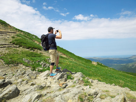
If you’re gearing up for a true British hillwalking adventure, mastering Ordnance Survey (OS) maps is your first rite of passage. These aren’t just any maps—they’re the gold standard for navigating every inch of the UK’s wild and unpredictable landscapes. Forget the glossy tourist pamphlets; OS maps are rugged, detailed, and made for those who crave real exploration. Each symbol on an OS map is a secret code to decipher, revealing ancient stone circles, remote bothies, and the ever-elusive trig points that dot the moors. From footpaths etched through sheep-dotted fells to dense woodland and craggy tors, every line and icon tells a story steeped in local history and topographical nuance.
The Language of Symbols
To walk like a Brit, you need to think like one—and that means recognising more than just roads and rivers. OS maps are packed with quirky British icons: kissing gates, dry stone walls, and mysterious earthworks. Learn these symbols by heart; they’ll be your best mates when the fog rolls in across Dartmoor or the Lake District clouds swallow your view.
Grid References: Pinpoint Precision
Now, let’s talk grid references—the true currency of UK navigation. Instead of vague directions, you’ll pinpoint locations using a system that’s as precise as a Royal Marine’s drill. Six-figure grid references will lead you straight to the summit cairn or safely off a blustery ridge before weather closes in. Master this skill, and you’ll never be caught out by the notorious British mist.
Contours: Reading the Land’s Story
Contours might look intimidating at first glance—a maze of brown squiggles—but crack their code, and you unlock a three-dimensional map in your mind. They reveal every rise and fall of Britain’s dramatic countryside, from gentle Cotswolds hills to Scotland’s jagged Munros. Understanding contour lines isn’t just about elevation—it’s about reading the mood of the land beneath your boots.
With these skills in hand, you’re no longer just following trails—you’re actively engaging with the landscape like generations of British explorers before you. The OS map becomes your passport to adventure, independence, and safety in some of the UK’s most challenging terrain.
2. Mastering the Compass: Traditional Tools in Modern Times
When it comes to navigating the wild and varied landscapes of the UK, nothing beats the reliability of a classic Silva compass. While GPS gadgets are handy, they can falter in remote dales or under thick cloud cover—your compass, however, is always ready for action. British hillwalkers have trusted this timeless tool for generations, especially when traversing unpredictable moors and mist-laden fells where paths vanish and landmarks blur into the grey. Let’s unleash the full potential of your compass and ensure you can plot a route with confidence, whatever the weather throws at you.
Taking a Bearing: Step-by-Step
To stay true on your chosen course, especially over undulating ground where features rise and fall out of sight, taking an accurate bearing is essential. Here’s how seasoned walkers across the Peaks and Highlands do it:
| Step | Action |
|---|---|
| 1 | Line up your map to north using your compass baseplate. |
| 2 | Place the edge of your compass between your current location and your target (e.g., next trig point). |
| 3 | Rotate the bezel so its orienting lines match the grid lines on your map. |
| 4 | Lifting your eyes to the landscape, hold the compass flat and turn until the red needle sits inside the orienting arrow—this is ‘boxing the needle’. |
| 5 | Select a visible feature along your bearing (a lone boulder or distant fence post) and stride towards it; repeat as terrain demands. |
Staying On Course Across British Terrain
The British uplands are notorious for their tricksy conditions—mist rolls in suddenly, ridges can look alike, and bogs offer few clues. By regularly checking your bearing and using intermediate waypoints, you’ll avoid wandering off-piste. Remember: never rely solely on trodden paths as sheep tracks often lead nowhere! Instead, trust your bearing, adjust for magnetic variation (currently a couple of degrees west in most regions), and tick off features as you go. This habit is what separates seasoned hillwalkers from those who end up flagged down by mountain rescue.
Essential Compass Tips for UK Hillwalkers
| Tip | Description |
|---|---|
| Avoid Metal Distractions | Keep compasses away from mobile phones or belt buckles—they can throw off readings dramatically. |
| Practice in Clear Weather First | Build confidence by navigating on familiar ground before tackling misty summits. |
| Always Double-Check Bearings | If something feels wrong—trust your instincts and recheck! |
| Add Pace Counting | In featureless terrain like Dartmoor or Kinder Scout, count your paces to estimate distance covered. |
The art of compass navigation is more than just technical skill—it’s about embracing adventure with confidence and resilience. Master these techniques and you’ll have what it takes to roam Britain’s wildest places safely, no matter how challenging the elements become.
3. Practical Navigation Techniques for Changeable UK Weather
When venturing into the British hills, you’re not just facing steep climbs and rocky paths—you’re up against some of the most unpredictable weather on the planet. One minute, you’re basking in rare sunshine; the next, a wall of mist can swallow your view whole. To tackle this with true grit, you need more than just basic navigation skills—you need a toolkit forged by experience and local know-how.
Staying Oriented in Whiteouts and Thick Fog
The Highlands are infamous for sudden whiteouts that erase every landmark from sight. In these moments, your map and compass become your lifeline. Master “boxing” around obstacles by plotting micro-routes between contour lines or using pacing to measure distance when visibility drops to arm’s length. Practice taking and following bearings religiously, as GPS signals can fail at altitude or in deep valleys. A quick tip: set your compass declination for UK grid north—just a few degrees off, and you could wander miles off course before realising it.
Micro-Navigation: The British Essential
On those foggy Lake District mornings where even sheep fade into the ether, micro-navigation is king. Use features like sheepfolds, walls, or isolated trees as handrails—these are marked meticulously on OS maps and can be navigational gold when everything else is lost in grey. Tick off each feature as you pass; this steady progress keeps panic at bay and ensures you always know precisely where you stand.
Adapting on the Fly: The Art of Re-Location
If the weather turns truly savage and your planned route becomes impassable, don’t hesitate to re-locate. Identify “attack points”—prominent features like streams or junctions—to recalibrate your position with map and compass. Trust your skills over tech; batteries die fast in cold rain, but a Silva compass never lets you down. Every seasoned hillwalker knows that in Britain, adaptability isn’t optional—it’s survival.
By honing these practical techniques and embracing the British spirit of adventure (and a bit of stubbornness), you’ll turn even the wildest weather into part of the story—not the end of it.
4. Recognising and Avoiding Common Navigational Hazards
Even for seasoned hillwalkers, the British hills are riddled with cunning obstacles waiting to catch out the unprepared. From treacherous peat bogs to intimidating crags and those morale-crushing false summits, knowing what you’re up against—and how to dodge trouble—could mean the difference between a triumphant summit selfie and a sodden, sorry retreat.
Identifying Classic UK Hillwalking Pitfalls
| Hazard | Description | Navigation Tips |
|---|---|---|
| Peat Bogs | Soggy, deceptive patches of ground that can swallow boots (or worse). | Check map contours for flat, marshy ground; spot dark patches on aerial photos; use your compass to skirt known bogs and stick to higher, drier paths. |
| Crags & Cliffs | Sheer drops or rocky outcrops often hidden in mist or bad weather. | Pay attention to tightly packed contour lines; keep a safe distance in poor visibility; use grid references to mark danger zones before setting off. |
| False Summits | Deceptive high points that trick you into thinking you’ve reached the top. | Match map features precisely—check the height of each peak using spot heights; don’t be fooled by optical illusions, especially in low cloud. |
How Navigation Skills Save Your Skin (and Socks)
Your map isn’t just a piece of paper—it’s your secret weapon. By reading contours like a pro and mastering compass bearings, you’ll spot potential hazards long before they catch you out. For example, learning to recognise the tell-tale signs of a boggy patch from the safety of a ridgeline can save you from an ankle-deep disaster. Similarly, plotting your route around crags ensures you stay well away from unexpected sheer drops, especially when the cloud rolls in—never underestimate just how fast British weather can turn! And with a careful check of map elevations and summit names, you won’t fall victim to the classic “one last push” syndrome at every false top.
Pro Tips for Navigating Hazardous Terrain
- Pace Yourself: Use pacing and timing techniques over tricky ground so you always know exactly where you are—even if visibility drops.
- Stay Alert: Regularly cross-reference your position on the map with landmarks (walls, streams, cairns). Don’t rely solely on intuition or memory.
- Avoid Shortcuts: Tempted to cut corners across open moorland? Think twice—those “easy” routes often lead straight into boggy chaos or unmarked cliffs.
- Prepare for Plan B: If conditions worsen or hazards block your way, have an alternative route ready mapped out—you’ll thank yourself later!
The Bottom Line
If adventure is what you seek on Britain’s wildest hills, then navigational mastery is your ticket to doing it safely. Spotting hazards early and navigating round them isn’t just smart—it’s essential for anyone who wants their hillwalking stories to end with a pint in the pub rather than a call to Mountain Rescue.
5. Essential UK Hillwalking Safety: Local Laws and Mountain Manners
If you think the wild British hills are a free-for-all, think again. The UKs patchwork of rights of way, access land, and private estates means every step can carry legal and ethical weight. Before you even unfold your Ordnance Survey map or sight a bearing with your compass, it’s vital to brush up on the country-specific rules that govern our right to roam. In Scotland, the Scottish Outdoor Access Code is your bible: it grants remarkable freedom to walkers but demands respect for privacy, farming, and conservation. Down in England and Wales, the Countryside Code lays out how to walk responsibly—think closing gates, keeping dogs under control, and leaving no trace but footprints.
Respecting Access and Boundaries
When navigating with map and compass, always check if your route crosses open access land or designated footpaths. Veering off course could mean trespassing, so accuracy isn’t just about not getting lost—it’s about staying legal. Remember, many areas allow access only at certain times due to lambing or shooting seasons; local signs aren’t mere suggestions.
Mountain Manners: Beyond the Compass
Your navigation skills should be matched by mountain manners. Yield to others on narrow paths, avoid shortcutting across sensitive ground (which can cause erosion), and greet fellow hillwalkers with a nod—its tradition! If you encounter livestock, give them a wide berth; keep dogs leashed near sheep or ground-nesting birds.
Navigation as Respect
Mastering map reading and compass work isn’t just about self-reliance; it’s about respecting the land and those who live and work there. By sticking to approved routes and following local guidance, you ensure your adventure remains exhilarating yet considerate—upholding the spirit of British hillwalking for generations to come.
6. Pushing Your Limits: Real-World Navigation Challenges
If you think map reading and compass skills are just textbook theory, it’s time to prove yourself where it counts—out on Britain’s most unforgiving hills. Fancy yourself a hardy hillwalker? Test your mettle with routes and scenarios that turn theory into gritty, wind-battered, mud-caked adventure across the UK’s wildest uplands.
Throwing Yourself in at the Deep End
There’s no substitute for experience under pressure. Picture this: the cloud rolls in across the Brecon Beacons, visibility plummets, and your GPS signal fizzles out. This is where true navigation prowess shines. Will you trust your bearings as the weather lashes your face, or will you fumble for technology that’s let you down?
Classic British Challenges Await
The Lake District’s craggy ridges, Scotland’s endless moorland, or Snowdonia’s maze of indistinct sheep tracks—all demand sharp eyes and sharper skills. Practise micro-navigation: track features like re-entrants and knolls on an Ordnance Survey map; count paces through ankle-deep bogs; triangulate your position when every hilltop looks identical in the clag.
Mistakes Are Lessons—If You Survive Them
Misreading a contour line can put you on the wrong side of a ridge or facing an unfordable river. Only by tackling these real-life tests will you discover your weaknesses and hone your strengths. Learn from every wrong turn and celebrate each summit reached with nothing but map, compass, and raw determination.
Join the Ranks of Britain’s True Adventurers
Every seasoned hillwalker has war stories: sudden whiteouts on Kinder Scout, losing the path on Dartmoor, or nightfall chasing them off Ben Nevis. Accept these challenges as rites of passage. Mastering navigation isn’t about ticking boxes—it’s about thriving when everything else conspires against you.
So grab your kit, brace yourself for the elements, and take on routes that force you to rely on skill rather than luck. Out here in Britain’s wild country, navigation isn’t just essential—it’s legendary.