The British Rambler’s Legacy
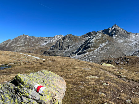
To wander the footpaths of Britain is to step into a living tapestry woven through centuries of tradition, hedgerows, and rolling hills. The British rambler is more than a walker—he or she is an explorer, a guardian of ancient rights-of-way, and a quiet observer of nature’s seasonal symphony. From the windswept fells of the Lake District to the chalky paths of the South Downs, rambling has long been cherished as a uniquely British pastime—a gentle rebellion against enclosure, urban bustle, and forgetting. In days gone by, hand-drawn maps, battered Ordnance Survey sheets, and keen local knowledge guided these journeys. Today, mapping software serves as the modern compass and companion for those who still seek solace in wildflower meadows and sun-dappled woodlands. As we embrace technology to plan and record our routes, we honour not only our own sense of adventure but also the enduring legacy of Britain’s public footpaths and bridleways—those green arteries that connect villages, histories, and hearts.
Choosing the Right Mapping Software
For any rambler setting off across Britain’s windswept downs or ancient woodland trails, the right mapping software can make the difference between a seamless adventure and a muddled misadventure. With so many options available, choosing tools suited to British landscapes and walking traditions requires careful consideration. Let’s explore some of the most ramble-friendly mapping apps and digital aids—each with their own strengths for planning, plotting, and recording your countryside journeys.
Top British Mapping Tools and Apps
The backbone of any walker’s toolkit in the UK is Ordnance Survey (OS) mapping. OS Maps offers detailed topographical information, footpaths, bridleways, and even ancient rights of way—features that global platforms often overlook. Other popular choices include ViewRanger (now integrated with Outdooractive), Komoot, and MapMyWalk. Each app brings its own blend of features tailored to the rambler’s needs.
Key Criteria for Selection
- British Path Coverage: Does it show public footpaths, permissive paths, and local rights of way?
- Accessibility: Is it easy to use for both beginners and seasoned walkers? Does it offer large text or high-contrast modes?
- Offline Use: Can you download maps for those signal-less moors and forest glades?
- Compatibility: Can you share routes with friends or local walking societies? Is there integration with GPS devices?
A Quick Comparison of Popular Mapping Apps
| App/Tool | OS Map Support | Offline Access | User-Friendliness | Walking Society Compatibility |
|---|---|---|---|---|
| OS Maps | Full UK coverage | Yes (Premium) | Very High | Widely supported by UK groups |
| Outdooractive/ViewRanger | Good UK support | Yes (with subscription) | High | Many groups use it |
| Komoot | Moderate UK support | Yes (per-region purchase) | User-friendly for all levels | Mainly individual use but supports sharing |
| MapMyWalk | Basic path info only | No (needs mobile data) | Straightforward interface | Lesser-used among societies |
Your choice will ultimately depend on your favourite haunts, how much detail you crave, and whether you prefer solo wandering or joining organised group walks. For those passionate about tradition and accuracy, OS Maps remains unrivalled; if you’re after social features or global compatibility, others may beckon. Whichever tool you select, let it become your companion as you trace hedgerow-lined lanes and misty fellside tracks—a faithful guide through Britain’s endless green labyrinths.
3. Plotting Your Route: Tips and Tricks
When it comes to planning a walk worthy of the British rambler, precision is more than a preference—it’s an art. Modern mapping software transforms this process into an immersive experience, allowing you to trace winding footpaths and ancient bridleways with the ease of a seasoned cartographer. But how do you ensure your plotted route honours both the land and its traditions?
Using UK-Specific Map Layers
Begin by selecting mapping tools that offer detailed Ordnance Survey (OS) layers—these are the gold standard for walkers across Britain. OS maps reveal not only terrain contours and woodland boundaries, but also those all-important public rights of way that criss-cross our countryside like threads in a well-worn tapestry. Many digital platforms now allow you to overlay these OS layers onto satellite imagery or topographical views, giving clarity to hedge-lined tracks and elusive stiles.
Highlighting Public Rights of Way
The patchwork of paths that define our green and pleasant land can be confusing at first glance. Mapping software tailored for the UK will highlight public footpaths, byways open to all traffic (BOATs), restricted byways, and permissive routes—each with their own distinct markings. Before setting out, double-check that your planned path follows these public ways; many platforms allow you to filter out private roads or fields, ensuring you stay firmly within your rights as a walker.
Tips for Avoiding Private Land
Navigating rural Britain requires sensitivity: not every inviting gate leads to a welcome. Use your software’s boundary features to distinguish between access land and private estates—look for shaded areas or dashed lines that indicate open access under the Countryside and Rights of Way Act (CRoW). If in doubt, consult local council resources or National Park authorities via integrated links within your mapping app. Always respect signage on the ground, even if your digital map suggests otherwise—landscapes change, and stewardship is part of the rambler’s creed.
With careful plotting, respect for tradition, and a keen eye on the digital map, your next adventure through the fens, dales, or moors will be as seamless as it is unforgettable—guided by both technology and the ancient spirit of exploration that defines rambling in Britain.
4. Recording and Sharing Your Rambles
There’s a special magic in capturing the spirit of your British ramble — not just for your own memory, but to share with fellow walkers who appreciate the subtle beauty of a windswept moor or the hush beneath ancient woodland. Modern mapping software offers a treasure trove of tools for recording every step, every sight, and every story along the way. Here’s how you can preserve and share your adventures with authenticity and a sense of place.
Capturing Every Moment: Digital Waypoints and Geo-Tagged Photos
With mapping apps tailored for UK walkers, you can drop digital waypoints at significant spots: the old stone stile where the view opens up, a hidden pond teeming with dragonflies, or that perfect bench for your flask of tea. Each waypoint can be annotated with notes — perhaps a line about the wildflowers in bloom or the sudden call of a skylark overhead. Most platforms also let you attach geo-tagged photos, so memories are anchored exactly where they were made.
Table: Recording Features in Popular Mapping Software
| Software | Digital Waypoints | Geo-Tagged Photos | Narrative Notes | UK Walking Community Integration |
|---|---|---|---|---|
| OS Maps | Yes | Yes | Yes | Strong (OS Explore) |
| Komoot | Yes | Yes | Yes | Moderate (Local Highlights) |
| ViewRanger | Yes | Yes | Yes | Good (BuddyBeacon) |
| Strava (Walking Mode) | No (Segments Instead) | No (Requires Manual Upload) | No (Kudos & Comments) | Limited (Mostly Running/Cycling) |
Narrative Storytelling: Bringing Your Ramble to Life
The best walks aren’t just about distance covered; they’re stories waiting to be told. Many mapping apps allow you to weave narrative into your route—adding snippets about local folklore, encounters with wildlife, or simply the weather’s caprice on a given day. This transforms your map from a line on the landscape to a living journal of discovery.
Sharing Best Practices in the British Walking Community
The walking community across Britain is a tapestry woven from shared knowledge and mutual respect. When sharing your mapped rambles:
- Avoid Sensitive Locations: Be mindful not to publicise routes over private land without permission or through habitats sensitive to disturbance.
- Add Local Insights: Share tips on stiles, dog-friendly stretches, good pubs for lunch, or seasonal hazards like mud or livestock.
- Cite Sources: If you’ve drawn inspiration from classic guidebooks or local legends, credit them in your notes—it’s part of our proud walking heritage.
- Engage Thoughtfully: Respond to comments and questions from fellow walkers, fostering a spirit of camaraderie rather than competition.
The Heartbeat of Shared Adventure
Your digitally recorded walk is more than data points — it’s an invitation for others to tread softly where you have wandered, to discover their own stories beneath the ever-changing British sky. By blending technology with tradition, we keep the heart of rambling beating strong from coast path to fell-top.
5. Navigating British Weather and Terrain
The British countryside is nothing if not capricious. A stroll through a sun-dappled wood can swiftly turn into a trudge through drenching rain and ankle-deep mud. For the rambler, this unpredictability is both a challenge and a cherished part of the adventure. The right mapping software becomes a steadfast companion, adapting as nimbly as you must to the whims of the weather and the shifting moods of the land.
Weather Alerts at Your Fingertips
No one knows drizzle like a Brit, nor how quickly a clear sky can cloud over in the dales or along the Cornish coast. Select mapping apps integrate localised weather updates—think Met Office feeds or real-time radar overlays—so you can see what’s rolling in before it rolls over you. Before heading out, check your route for forecasted squalls or sudden cold snaps. On the trail, live notifications help you decide whether to press on, seek shelter beneath an ancient oak, or simply don your waterproofs with stoic resolve.
Muddy Tracks and Route Adaptation
After weeks of rain, that promising bridleway may become an impassable bog. Digital mapping tools allow for nimble rerouting: drop pins where paths are waterlogged, consult user-contributed reports about conditions underfoot, and tap into satellite imagery to spot alternative routes across higher ground. Many apps now feature terrain overlays—contour lines, elevation profiles, and even mud risk indicators—helping you avoid quagmires and keep your boots (relatively) dry.
Recording for Future Walkers
Your own rambling stories feed back into the collective knowledge of Britain’s walking community. Mapping software lets you annotate your journey with notes on tricky stiles, flooded meadows, or hidden footbridges that proved a godsend during a downpour. By sharing these updates—complete with time-stamped photos—you offer guidance to fellow walkers who may follow in your footsteps under similar skies.
Offline Maps for Remote Rambles
The most spectacular corners of Britain—the Lake District’s craggy fells, Dartmoor’s windswept tors—are often those where phone signal falters. Download offline maps before you set off so that you’re never left guessing at a fork in the track when clouds descend. Many apps also let you cache weather data and emergency contacts, ensuring you’re prepared if conditions take a turn for the dramatic.
By weaving together up-to-the-minute digital insights with age-old British walking wisdom, mapping software transforms every walk into a tale resilient to rain, fog, or muddy detour—a celebration of both technology and tradition under ever-changing skies.
6. Preserving and Respecting the Land
To ramble across the British countryside is to enter into a centuries-old conversation between humankind and nature. Each footstep along a sun-dappled bridleway or misty fell path is both an act of discovery and a gesture of stewardship. As modern mapping software guides our boots through ancient woodlands, windswept moors, and hidden coastal coves, it quietly asks us to tread with care—and to listen to the subtle stories of the land itself.
The Rambler as Nature’s Guardian
Every rambler is, in some sense, a guardian of the green tapestry that stretches from Cornwall’s hedgerows to Scotland’s highlands. Mapping technology empowers us to plan routes that avoid sensitive habitats, respect designated footpaths, and sidestep nesting grounds or protected flora. The digital map becomes more than a tool for wayfinding; it evolves into a companion that gently reminds us of our responsibility to walk lightly, leaving only the briefest trace—a whisper in the grass or a fleeting print in the mud.
Recording Quiet Stories
With each journey recorded, mapping apps enable us to notice and remember: the patch of bluebells by an old stone stile, the fox glimpsed at twilight near a forgotten farmstead, the chorus of skylarks above a windswept hill. By tagging these moments—places where nature’s presence felt especially profound—we help build a shared archive of local wonders. This collective memory encourages fellow walkers to seek out beauty without disturbing its delicate balance.
Promoting Respect Through Technology
The very act of plotting and sharing routes can foster a culture of respect. Many mapping platforms now allow users to flag areas in need of extra care or highlight seasonal closures for wildlife protection. Such features transform every rambler into an ambassador for Britain’s wild spaces. In following digitally mapped guidance on access codes and conservation zones, we honour traditions like the Countryside Code—not as burdens, but as invitations to walk thoughtfully and gratefully upon ancient ground.
In the end, mapping software does more than guide our adventures; it deepens our kinship with the land. By blending technology with mindfulness, British ramblers preserve not only their own memories but also the quiet stories written in blossom, birdsong, and mossy silence—stories waiting patiently for those who know how to see and how to care.