1. The Origins of Ordnance Survey
When you unfold an Ordnance Survey (OS) map today, it’s easy to forget the remarkable journey that brought these detailed guides into our hands. The story of Ordnance Survey begins in the late 18th century, rooted firmly in military necessity. In 1791, the threat of invasion from France prompted the British government to commission comprehensive mapping of the country, ensuring strategic readiness and national security. This initial focus on military mapping soon expanded, as the value of accurate maps for daily life became apparent.
The very name “Ordnance Survey” reflects its origins: “ordnance” refers to military supplies and artillery. The first major project was a detailed map of Kent, completed with painstaking care and precision—qualities that have become hallmarks of OS maps ever since. Over time, Ordnance Survey evolved beyond its military roots, gradually becoming a trusted source for explorers, walkers, families planning outings, and professionals alike. Today, OS stands at the heart of British outdoor culture, offering maps that combine historical expertise with practical everyday use for everyone across Britain.
Types of Ordnance Survey Maps
When it comes to exploring the beautiful and varied British countryside, knowing which type of Ordnance Survey (OS) map to choose can make all the difference. OS maps come in several formats, each designed with a specific user and purpose in mind. Whether you’re planning a family day out, tackling a long-distance hike, or navigating through your local town, there’s an OS map perfectly suited for your adventure.
The Two Main Series: Landranger and Explorer
The two most popular series are the Landranger and Explorer maps. Both are widely used across the UK, but they have unique features that cater to different needs:
| Map Series | Scale | Main Use | Key Features |
|---|---|---|---|
| Landranger (Pink Cover) | 1:50,000 | General navigation, road trips, cycling, longer walks | Covers a larger area; ideal for overview planning; includes motorways, A roads, tourist sites |
| Explorer (Orange Cover) | 1:25,000 | Walking, hiking, detailed route planning, local exploring | More detail; shows footpaths, bridleways, field boundaries; perfect for countryside adventures |
Other Notable OS Map Types
- OS Tour Maps: Great for holiday planning and scenic drives—covering popular destinations with points of interest marked.
- OS Road Maps: Designed mainly for drivers—features main roads and key travel information.
- Custom Made Maps: Choose your own centre point and scale—excellent as personalised gifts or for commemorating special journeys.
Choosing the Right Map for Your Adventure
If you’re heading out on a family ramble or want to spot hidden gems off the beaten path, the Explorer series is likely your best friend. For broader excursions where you need an overview of a region—perhaps for a cycling tour or a weekend road trip—the Landranger will serve you well. Each series uses clear British symbols and terminology familiar to locals and visitors alike, making navigation straightforward wherever your journey takes you.
3. How to Read an Ordnance Survey Map
If you’ve ever fancied a ramble through the rolling hills or historic footpaths of Britain, knowing how to read an Ordnance Survey (OS) map is your ticket to adventure. These maps are packed with information, but once you get the hang of the symbols and features, they open up a whole new world of exploring. Let’s break down the essentials so you can stride out with confidence.
Understanding Map Symbols
Ordnance Survey maps use a unique set of symbols to represent everything from ancient churches and public toilets to woodland and motorways. You’ll find a handy key (or legend) on every OS map, so don’t worry if you forget what a pink dashed line means! For example, blue lines show rivers and streams, while green shading often marks woods or forests. Familiarise yourself with common icons such as picnic sites, campsites, and viewpoints—these are especially useful for family outings or planning rest stops.
Getting to Grips with Scale
Scale tells you how much the real world has been shrunk to fit on the map. The most popular OS maps are 1:25,000 (Explorer series) and 1:50,000 (Landranger series). On a 1:25,000 map, 4 centimetres equal 1 kilometre in real life. The larger the scale (i.e., the smaller the number), the more detail you’ll see. For close-up countryside walks, go for Explorer; if you’re planning a longer journey by car or bike, Landranger might be just right.
Navigating Grid References
Grid references are your secret weapon for pinpointing locations. The British National Grid divides maps into squares using blue lines and numbers along the edges. Each square has its own code—a simple way to describe exactly where you are or want to go. A four-figure grid reference gets you to a square within 1km; a six-figure reference narrows it down to 100 metres. It’s as easy as reading along the bottom first (eastings), then up the side (northings).
Spotting Key Features
Look out for contour lines—those wiggly brown lines that show hills and valleys. The closer together they are, the steeper the ground. Footpaths, bridleways, and byways each have their own style of dashed line; learning these will help you choose routes that suit everyone in your group, from seasoned hikers to little ones with short legs.
Practical Tips for Confident Navigation
Before heading out, plan your route using landmarks like churches, bridges, or distinctive bends in rivers—these stand out both on the map and in real life. Bring a compass to match what’s on paper with what’s in front of you. And remember: practice makes perfect! Try navigating familiar local walks at first before venturing further afield.
With these basics under your belt, Ordnance Survey maps become more than just paper—they’re an invitation to discover Britain’s countryside at your own pace, together as a family.
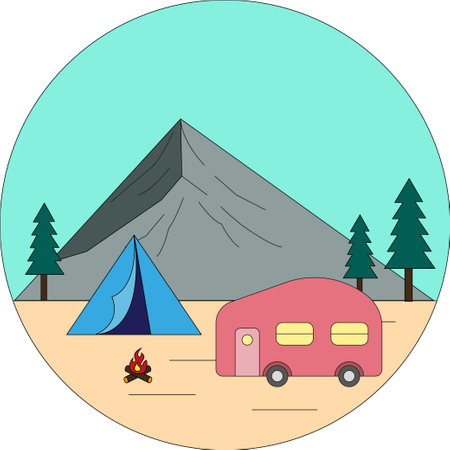
4. Practical Uses in Everyday Life
Ordnance Survey (OS) maps are more than just tools for hikers and explorers; they’re an essential part of everyday life for families across the UK. Whether you’re planning a gentle Sunday stroll, a family picnic in the countryside, or a full-blown camping holiday, OS maps offer detailed information to make your day out enjoyable and safe.
Planning Family Days Out
When looking for new adventures close to home or further afield, OS maps help families discover walking trails, cycle routes, and hidden gems like local woods or historic landmarks. With clear markings for footpaths, bridleways, and public rights of way, even those unfamiliar with an area can confidently plan a route suitable for all ages.
Staying Safe Outdoors
Safety is always a top priority on any outing. OS maps provide vital details such as elevation changes, water features, and potential hazards (like cliffs or marshy ground). This information allows families to choose safe routes and avoid getting lost or encountering unexpected challenges.
Practical Uses at a Glance
| Activity | How OS Maps Help |
|---|---|
| Rambles & Walks | Show footpaths, distances, terrain types, and landmarks for navigation |
| Cycling Trips | Highlight cycle-friendly routes and gradients for all abilities |
| Packing Picnics | Identify scenic spots, picnic areas, and nearby facilities |
| Holiday Adventures | Plan multi-day journeys with campsites, attractions, and transport links |
| Emergency Situations | Quickly locate nearest roads, villages, or rescue points if needed |
Embracing OS maps transforms ordinary outings into memorable experiences. They empower everyone—from young children to grandparents—to explore the great British outdoors with confidence and curiosity. Next time you’re planning a day out or a UK holiday adventure, don’t forget to pack your trusty Ordnance Survey map!
5. Digital Mapping: Ordnance Survey in the Modern Era
Gone are the days when you needed to unfold a paper map on a windy hillside or sit at your kitchen table plotting routes with a pencil. Today, Ordnance Survey has fully embraced the digital age, providing Britons with a wealth of online and mobile resources that make exploring the UK easier than ever before. Yet, these modern tools don’t replace traditional skills—they complement them, offering the best of both worlds for families and keen walkers alike.
With the Ordnance Survey’s OS Maps app and web platform, users can access detailed mapping anywhere in Great Britain at the tap of a finger or click of a mouse. Whether you’re planning a country ramble in the Cotswolds or navigating city streets in Edinburgh, these digital maps offer pinpoint accuracy and handy features like GPS tracking, custom route planning, and live location sharing—perfect for staying safe and connected on family outings.
Blending Old Skills with New Tech
While digital maps are wonderfully convenient, there’s still something special about knowing how to read a traditional OS map. The symbols, contours, and grid references remain the same, so your well-honed map reading skills come in handy even on a smartphone screen. In fact, many seasoned walkers recommend carrying a paper map as a backup—after all, batteries don’t last forever!
Family Adventures Made Simple
The rise of digital mapping means it’s easier than ever to get everyone involved in planning your next adventure. Children love following their progress on an interactive map, while parents appreciate features like route suggestions and points of interest. Whether you’re after a gentle stroll or an energetic hike, OS digital resources help you find just the right path for every member of the family.
A British Essential for Modern Life
For Britons on the move—whether you’re commuting, holidaying, or simply enjoying the great outdoors—the Ordnance Survey’s digital offerings provide peace of mind alongside their famous reliability. So next time you set off on an adventure, remember: combining traditional know-how with modern technology is truly the way forward.
6. Preserving the Legacy: Caring for Your Maps
Ordnance Survey maps are more than just navigational tools—they are a piece of British history, filled with stories and memories. Whether you’ve inherited your maps or picked them up on family rambles, caring for them ensures they remain a cherished part of your household for years to come. Here are some practical tips and tricks to keep your OS maps in tip-top condition, ready to be passed down through the generations.
Handle with Care
Always handle your maps with clean, dry hands to avoid smudges and stains. Consider using a soft pencil if you need to mark routes—these can be gently erased later without damaging the paper.
Keep Them Dry and Safe
British weather is famously unpredictable! If you’re taking your map outdoors, pop it in a clear, waterproof map case. At home, store your maps flat in a dry place away from direct sunlight to prevent fading and mildew.
Fold Along Original Lines
When folding your map after use, always follow the original creases. This helps prevent new tears and keeps the map looking neat. If a tear does appear, repair it promptly with acid-free tape suitable for archival materials.
Avoid Overloading Your Map
It’s tempting to tuck tickets or notes inside your folded map, but this can strain the paper and cause splits at the folds. Keep memorabilia in a separate envelope or scrapbook instead.
Create Family Traditions
Why not make it a family tradition to add gentle annotations (with dates!) marking special walks or discoveries? Over time, these notes become treasured heirlooms in themselves, telling the story of your family’s adventures alongside Britain’s changing landscape.
Pass Them Down With Pride
With proper care, Ordnance Survey maps can last for decades—sometimes even centuries. When the time comes, pass them on to the next generation along with their stories, ensuring that the spirit of exploration remains alive in your family for years to come.